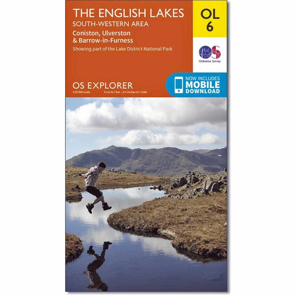
Explorer Active OL6 The English Lakes Map - SE Area
OS Explorer is the Ordnance Survey's most detailed map and is recommended for anyone enjoying outdoor activities such as walking, horse riding and off-road cycling. The series provides complete GB coverage and can now be used in all weathers thanks to OS Explorer - Active, a tough, versatile version of OS Explorer. The OS Explorer Active range of OL maps now includes a digital version of the paper map, accessed through the OS smartphone app, OS Maps.
The OS Explorer map of The English Lakes, South Eastern area is a must-have when visiting this area of the Lakes District.
Explore the market town of Ulverston — a stunning labyrinth of gorgeous old buildings and cobbled streets. Take on the highest peak in England, Scafell Pike, or check out Coniston Village — a beautiful village that sits at the mouth of Coppermines Valley and Yewdale Beck.
Our OS Explorer maps are perfect for day-tripping, extensive hikes, and cycling.
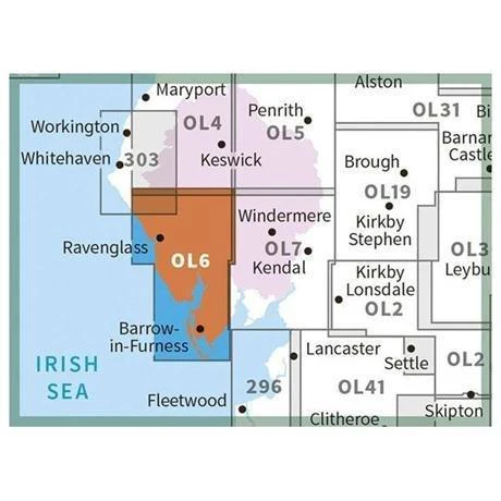
- Coniston, Ulverston & Barrow-in-Furness
- 100% recyclable
- Weatherproof
- 1:25,000
Original: $23.14
-65%$23.14
$8.10More Images


Explorer Active OL6 The English Lakes Map - SE Area
OS Explorer is the Ordnance Survey's most detailed map and is recommended for anyone enjoying outdoor activities such as walking, horse riding and off-road cycling. The series provides complete GB coverage and can now be used in all weathers thanks to OS Explorer - Active, a tough, versatile version of OS Explorer. The OS Explorer Active range of OL maps now includes a digital version of the paper map, accessed through the OS smartphone app, OS Maps.
The OS Explorer map of The English Lakes, South Eastern area is a must-have when visiting this area of the Lakes District.
Explore the market town of Ulverston — a stunning labyrinth of gorgeous old buildings and cobbled streets. Take on the highest peak in England, Scafell Pike, or check out Coniston Village — a beautiful village that sits at the mouth of Coppermines Valley and Yewdale Beck.
Our OS Explorer maps are perfect for day-tripping, extensive hikes, and cycling.
- Coniston, Ulverston & Barrow-in-Furness
- 100% recyclable
- Weatherproof
- 1:25,000
Product Information
Product Information
Shipping & Returns
Shipping & Returns
Description
OS Explorer is the Ordnance Survey's most detailed map and is recommended for anyone enjoying outdoor activities such as walking, horse riding and off-road cycling. The series provides complete GB coverage and can now be used in all weathers thanks to OS Explorer - Active, a tough, versatile version of OS Explorer. The OS Explorer Active range of OL maps now includes a digital version of the paper map, accessed through the OS smartphone app, OS Maps.
The OS Explorer map of The English Lakes, South Eastern area is a must-have when visiting this area of the Lakes District.
Explore the market town of Ulverston — a stunning labyrinth of gorgeous old buildings and cobbled streets. Take on the highest peak in England, Scafell Pike, or check out Coniston Village — a beautiful village that sits at the mouth of Coppermines Valley and Yewdale Beck.
Our OS Explorer maps are perfect for day-tripping, extensive hikes, and cycling.
- Coniston, Ulverston & Barrow-in-Furness
- 100% recyclable
- Weatherproof
- 1:25,000