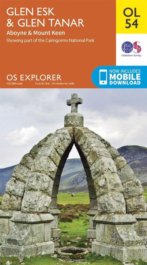
Explorer OL54 Glen Esk & Glen Tanar Map
With few settlements, the area around Glen Esk and Geln Tanar is best explored on foot.
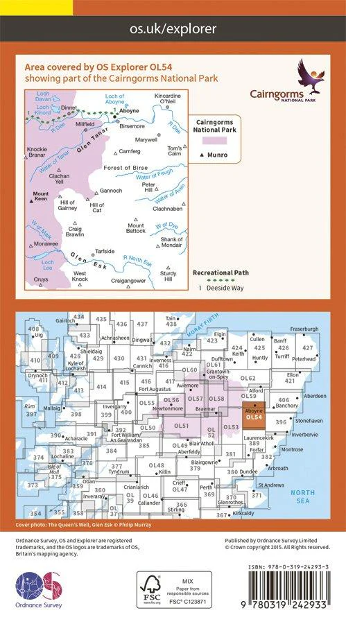
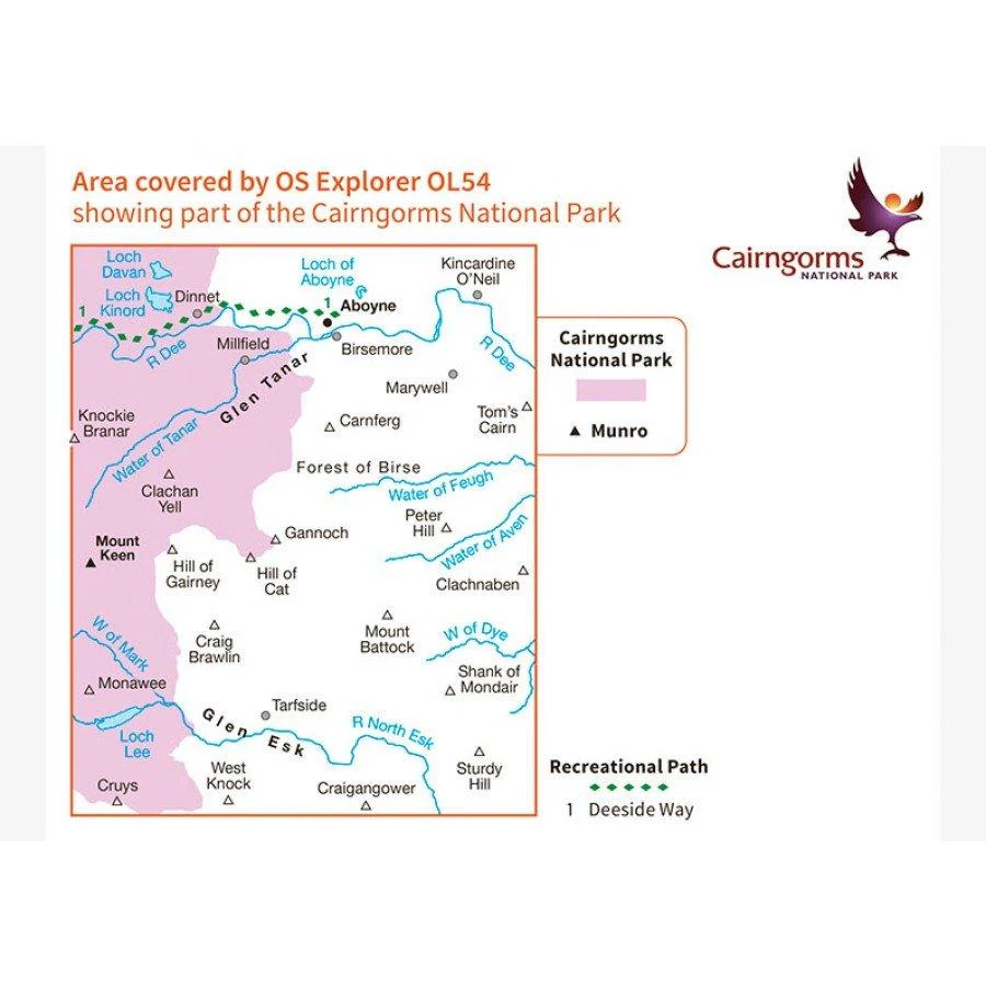
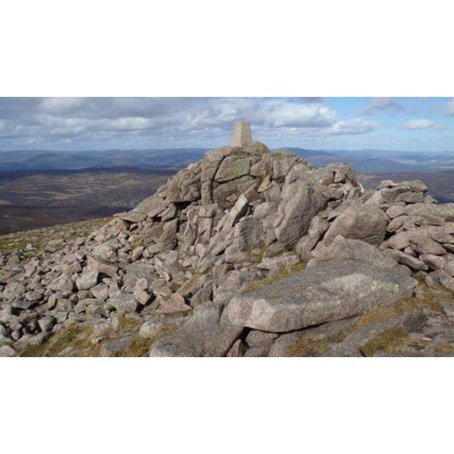
OL 54 includes part of the Cairngorms National Park,the Deeside Way and Mount Keen, at 939m. See if you can reach the Trig point at the peak. This map replaces the previous OS Explorer map 395 for this area.
With this map you will receive a code for use on your iOS or Android smartphone or tablet, simply download the OS app from the app store for free enter the unique code on your map and you're ready to go!
Please note we can not accept maps which have had the panel covering the unique code back for a refund or exchange.
- 1:25,000 Scale
- Publication Date: 10/06/15
More Images
Explorer OL54 Glen Esk & Glen Tanar Map
With few settlements, the area around Glen Esk and Geln Tanar is best explored on foot.
OL 54 includes part of the Cairngorms National Park,the Deeside Way and Mount Keen, at 939m. See if you can reach the Trig point at the peak. This map replaces the previous OS Explorer map 395 for this area.
With this map you will receive a code for use on your iOS or Android smartphone or tablet, simply download the OS app from the app store for free enter the unique code on your map and you're ready to go!
Please note we can not accept maps which have had the panel covering the unique code back for a refund or exchange.
- 1:25,000 Scale
- Publication Date: 10/06/15
Product Information
Product Information
Shipping & Returns
Shipping & Returns
Description
With few settlements, the area around Glen Esk and Geln Tanar is best explored on foot.
OL 54 includes part of the Cairngorms National Park,the Deeside Way and Mount Keen, at 939m. See if you can reach the Trig point at the peak. This map replaces the previous OS Explorer map 395 for this area.
With this map you will receive a code for use on your iOS or Android smartphone or tablet, simply download the OS app from the app store for free enter the unique code on your map and you're ready to go!
Please note we can not accept maps which have had the panel covering the unique code back for a refund or exchange.
- 1:25,000 Scale
- Publication Date: 10/06/15