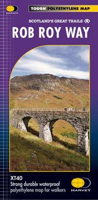
Rob Roy Way Map
One of the best trails in Scotland, the Rob Roy Way crosses the Southern Highlands of Scotland. It is 124km in length and has an alternative route at 151km. Starting at Drymen the route goes north east and finishes up in Pitlochry. The track passes through Aberfoyle, Callander, Strathyre, Killin and Aberfeldy and includes the lochs Venachar, Lubnaig and Tay.
- Scale: 1:40,000
- Ratio: 2.5cm = 1km
- Flat Size: 972 x 700mm
- Folded Size: 116 x 243mm
- Weight: 60g
- Single sided
- 100% waterproof
Product Information
Product Information
Shipping & Returns
Shipping & Returns
Description
One of the best trails in Scotland, the Rob Roy Way crosses the Southern Highlands of Scotland. It is 124km in length and has an alternative route at 151km. Starting at Drymen the route goes north east and finishes up in Pitlochry. The track passes through Aberfoyle, Callander, Strathyre, Killin and Aberfeldy and includes the lochs Venachar, Lubnaig and Tay.
- Scale: 1:40,000
- Ratio: 2.5cm = 1km
- Flat Size: 972 x 700mm
- Folded Size: 116 x 243mm
- Weight: 60g
- Single sided
- 100% waterproof