✨ New Arrivals Just Dropped!Explore
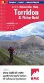
Torridon Fisherfield Mtn Map
; "HARVEY British Mountain Maps are a joy to use. The detail and accuracy make them my first choice when I am researching a route or just out on the hills for fun". Peter Macfarlane, outdoor writer and photographer.; The giants of Torridon and the remote hills of Fisherfield on one sheet at scale 1:40,000 scale.; The map area includes 18 Munros and 12 Corbetts.; Enlargements at 1:15,000 scale of An Teallach, Beinn Alligin, Beinn Eighe and Liathach on the reverse.; Geological map of Torridon and Fisherfield; Printed on polyethylene - durable, tear-resistant and 100% waterproof; Made in cooperation with the British Mountaineering Council and the Mountaineering Council of Scotland; Colour shading for easy identification of hills and valleys; Climbing crags are highlighted and climbing route diagrams included.; Less than half the weight of a laminated map
$9.03
Original: $25.81
-65%Torridon Fisherfield Mtn Map—
$25.81
$9.03Torridon Fisherfield Mtn Map
; "HARVEY British Mountain Maps are a joy to use. The detail and accuracy make them my first choice when I am researching a route or just out on the hills for fun". Peter Macfarlane, outdoor writer and photographer.; The giants of Torridon and the remote hills of Fisherfield on one sheet at scale 1:40,000 scale.; The map area includes 18 Munros and 12 Corbetts.; Enlargements at 1:15,000 scale of An Teallach, Beinn Alligin, Beinn Eighe and Liathach on the reverse.; Geological map of Torridon and Fisherfield; Printed on polyethylene - durable, tear-resistant and 100% waterproof; Made in cooperation with the British Mountaineering Council and the Mountaineering Council of Scotland; Colour shading for easy identification of hills and valleys; Climbing crags are highlighted and climbing route diagrams included.; Less than half the weight of a laminated map
Product Information
Product Information
Shipping & Returns
Shipping & Returns
Description
; "HARVEY British Mountain Maps are a joy to use. The detail and accuracy make them my first choice when I am researching a route or just out on the hills for fun". Peter Macfarlane, outdoor writer and photographer.; The giants of Torridon and the remote hills of Fisherfield on one sheet at scale 1:40,000 scale.; The map area includes 18 Munros and 12 Corbetts.; Enlargements at 1:15,000 scale of An Teallach, Beinn Alligin, Beinn Eighe and Liathach on the reverse.; Geological map of Torridon and Fisherfield; Printed on polyethylene - durable, tear-resistant and 100% waterproof; Made in cooperation with the British Mountaineering Council and the Mountaineering Council of Scotland; Colour shading for easy identification of hills and valleys; Climbing crags are highlighted and climbing route diagrams included.; Less than half the weight of a laminated map