✨ New Arrivals Just Dropped!Explore
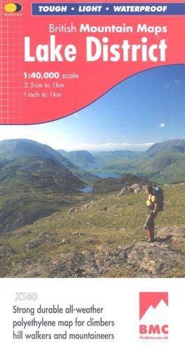
Lake District Mountain Map
"The best Lake District map I have ever seen. The 1:40,000 scale provides clear, detailed information to one of the most popular hill walking areas in Britain." Sir Chris Bonington
The Lake District's famous mountains and fells on a single map
Printed on polyethylene - durable, tear-resistent and 100% waterproof
Made in cooperation with the British Mountaineering Council
Colour shading for easy identification of hills and valleys
Detailed crag information for climbers
Less than half the weight of a laminated map
Detailed 1:20,000 enlargements of Scafell and Pillar
Geological map of the Lake District supplied by the British Geological Survey
Mountain incident and first aid advice
Tips on using your map and compass
Useful local phone numbers and websites
- Printed on polyethylene - durable, tear-proof and 100% waterproof
- Made in cooperation with the BCM
- Colour shading for easy identification of hills and valleys
- Detailed crag information for climbers
- Less than half the weight of a laminated map
- Detailed 1:20,000 enlargements of Scafell and Pillar on reverse
$25.81
Lake District Mountain Map—
$25.81
Lake District Mountain Map
"The best Lake District map I have ever seen. The 1:40,000 scale provides clear, detailed information to one of the most popular hill walking areas in Britain." Sir Chris Bonington
The Lake District's famous mountains and fells on a single map
Printed on polyethylene - durable, tear-resistent and 100% waterproof
Made in cooperation with the British Mountaineering Council
Colour shading for easy identification of hills and valleys
Detailed crag information for climbers
Less than half the weight of a laminated map
Detailed 1:20,000 enlargements of Scafell and Pillar
Geological map of the Lake District supplied by the British Geological Survey
Mountain incident and first aid advice
Tips on using your map and compass
Useful local phone numbers and websites
- Printed on polyethylene - durable, tear-proof and 100% waterproof
- Made in cooperation with the BCM
- Colour shading for easy identification of hills and valleys
- Detailed crag information for climbers
- Less than half the weight of a laminated map
- Detailed 1:20,000 enlargements of Scafell and Pillar on reverse
Product Information
Product Information
Shipping & Returns
Shipping & Returns
Description
"The best Lake District map I have ever seen. The 1:40,000 scale provides clear, detailed information to one of the most popular hill walking areas in Britain." Sir Chris Bonington
The Lake District's famous mountains and fells on a single map
Printed on polyethylene - durable, tear-resistent and 100% waterproof
Made in cooperation with the British Mountaineering Council
Colour shading for easy identification of hills and valleys
Detailed crag information for climbers
Less than half the weight of a laminated map
Detailed 1:20,000 enlargements of Scafell and Pillar
Geological map of the Lake District supplied by the British Geological Survey
Mountain incident and first aid advice
Tips on using your map and compass
Useful local phone numbers and websites
- Printed on polyethylene - durable, tear-proof and 100% waterproof
- Made in cooperation with the BCM
- Colour shading for easy identification of hills and valleys
- Detailed crag information for climbers
- Less than half the weight of a laminated map
- Detailed 1:20,000 enlargements of Scafell and Pillar on reverse